Leaflet Map Control
Use Proportional Markers in a Map
Technologies > User Interface Add-Ins > Geographic Information System (GIS) Views > Proportional Markers (Leaflet)
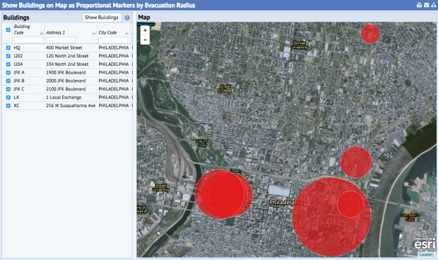
This example uses thematic proportional markers to display buildings in Philadelphia according to building evacuation radius. Markers are sized in real-world units according to their evacuation radius.
To use proportional markers, add the required proportional marker options to markerProperties. Specify the field containing the radii values in proportionalField. This approach uses the proportional renderer.
var markerProperties = { // optional radius: 7, fillColor: '#e41a1c', fillOpacity: 0.70, stroke: true, strokeColor: '#fff', strokeWeight: 1.0, // required for proportional markers renderer: 'proportional', proportionalField: 'bl.radius_evac' }; this.mapControl.createMarkers( dataSource, geometryFields, titleField, contentFields, markerProperties );
View: http://localhost:8080/archibus/ab-leaflet-map-proportional-renderer.axvw